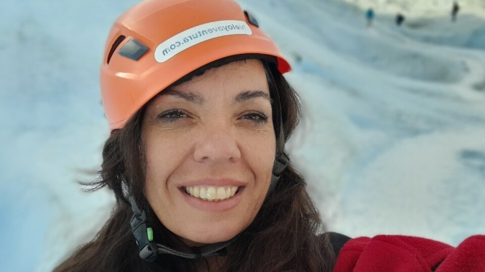
Maria Gabriella Lenzano: “I work in science because I am passionate about asking questions and imagining” | an interview
Lake Vidma, located in Santa Cruz County, is the deepest in America and the fifth in the world. This latest discovery is the result of the work of a team of researchers coordinated by Maria Gabriella Lenzano, PhD in Engineering from Cuyo National University. The group consists of engineers from different disciplines and a geographer from the Laboratory of Andean Geomatics (LAGEAN) of the Institute of Aquatic Biology, Glaciology and Ecology of CONICET. According to their findings, the considered water body has a depth of 900 meters and is located in an unexplored area of the Los Glaciares National Park, which until recently was occupied by the Vidma glacier. Declining surface ice from 2014 to the present has exposed the area to an advance toward the lake.
The expedition led by Lenzano was funded by UNCUYO’s Regional Center for Geosciences (ICEs).
In an interview with the University Extension, the LAGEAN official, who is also a land surveying engineer from San Juan National University (UNSJ), explained that the team of researchers is “taking up the numerical study of natural processes and doing environmental monitoring, focusing on the ecology of the glacier.”
What prompted you to make this discovery in Lake Vidma?
– In fact, we’ve been making headway in the region for more than a decade. The work at Lake Viedma is part of a series of investigations we have conducted in Los Glaciares National Park. This task is based on measuring the depth of Lake Vidma from a boat and with special equipment. The bottom is not flat and we assume it has a complex terrain. We’ve been in the glacier since 2011. At that time it was covering a larger area to the east; Even tourist trips were running on its surface. Over the past few years, as the glacier began to recede, companies canceled excursions. The first bathymetric measurements (techniques for calculating depths) were made in 2014. The glacier descends from the Southern Patagonian Ice Field (the extension of continental ice in the Patagonian Andes, on the borders of Argentina and Chile) and is part of the Patagonian River Basin. Santa Cruz River. You fell back in a very important way. It has lost 5 square kilometers of surface and almost 2 longitudinal kilometers. In May of this year, we decided to conduct another campaign to add new bathymetric measurements in the area that was recently abandoned by the glacier. At first I was surprised by the results: 900 meters deep and 650 meters below sea level.
What will this discovery allow you to do on a scientific level?
The discovery brings us closer to knowing what the bottom of the lake looked like, where the glacier was resting until a few years ago. It allows us to get a 3D map, to see the areas where the sediments are. It could give us the opportunity to see how the glacier behaves. We will work there.
Why do glaciers lose mass?
L- Southern Ice Field glaciers, in general, and in the world, have lost their mass since the mid-20th century due to climate change, but there are also local factors that make glaciers behave somehow depending on where they are. The Vidma glacier is not immune to these changes, and its mass balance remains negative.
“Going to and exploring the study area is quite a challenge, but we enjoy it. From a research point of view, the behavior of glaciers in Patagonia presents a series of complexities that significantly feed the studies we are developing.”
Why is the behavior of glaciers different by region?
For – in general, glaciers recede, but in fact, it is local conditions that cause glaciers to behave differently from one basin to another. For example, within the basin of the Santa Cruz River, the Upsala glacier that ends in Lago Argentino and the Viedma glacier that ends in the lake of the same name have receded during the past century.
However, Perito Moreno has a completely different behavior, at least for now. The Perito Moreno Glacier behaves like an oscillator. It advanced about a kilometer about a century ago and gained a position very close to the Magellan Peninsula. Since then, limited by the surrounding terrain, it has experienced slight advances and retreats, within a range of less than 150 metres. When the glacier approaches the peninsula, it usually generates an ice dam. These events are part of the dynamics acquired during the last century, which generate forward oscillations, consisting of repeated cycles of advance and retreat of the front. The advanced stages are from June to December and the previous stages are from December to April. Therefore, the gradual increase in this water level, in most cases, culminates in a sudden rupture of the dam, which results in a sudden influx of the volume of water into Lake Argentino, causing the collapse of the dam. These rips are the tourist attraction of the glacier, where people go and take pictures. Beautiful natural scenery, in that beautiful glacier is Perito Moreno.
How are measurements made?
L – We did it from a boat provided by the National Park Service. We measure the depth of the lake with a sensor that sends a signal in the form of waves that propagate through the water medium until they reach the bottom of the lake and are reflected back on the surface. The device measures the time it takes for a wave to travel to an object and bounce back. This gives us information about what is at a certain depth in that place.
Why did you choose this area to investigate?
LI began working in the Central Andes, in the Aconcagua National Park. For a decade, in general, my research has focused on Patagonia. Personally, I work in science because I am passionate about asking myself questions and imagining. For those of us who live in Mendoza, getting to the work area means traveling 3,200 kilometers in a truck. Going to and exploring the study area is quite a challenge, but we enjoy it. From a research point of view, the behavior of glaciers in Patagonia presents a series of complexities that significantly fuel the studies we are developing. We’ve been doing research for a decade and directing five PhD theses in the area. I personally choose it and can extend it to the entire LAGEAN team: the area caught us, it’s great.

“Award-winning zombie scholar. Music practitioner. Food expert. Troublemaker.”

/cloudfront-eu-central-1.images.arcpublishing.com/prisa/AHVYMMDSTZDTDBFNZ3LMFUOKNE.jpg)