Drones for a more comprehensive science

Earth and Technology No. 60 | author: Fernando Porras Castillo He is a geologist from the University of Barcelona and CEO of Drones for geologyPioneering project. He is a registered geologist (7920 N).
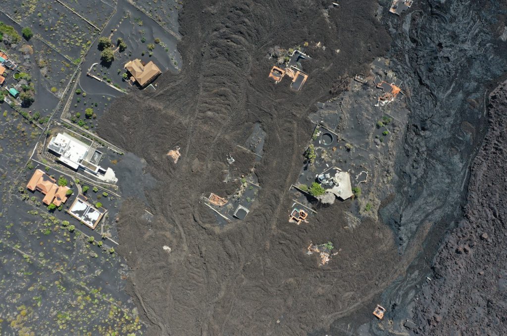
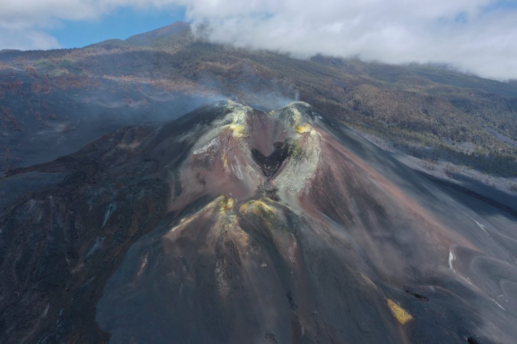
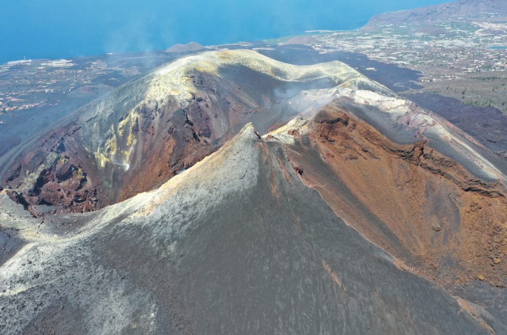
A little over a year ago, on September 19, 2021, the general public, both nationally and from the national and international scientific community, held their breath and focused their attention on geology, due to the eruption of the Tajogaite volcano, in the Cumbre Vieja volcanic complex in the southwestern region of the La Palma archipelago The canary. While managing this critical situation, drones (such as those of the IGME Air Action Service) have given the possibility to anticipate, monitor and take sampling without endangering human life and certainly made it possible to improve the management of the phenomenon and its associated risks, apart from demonstrating the great benefit of these teams . One of the controversies about this position at this time was avalanches of information and rumors traveling at full speed, management and communication by scholars of knowledge to the public and other scholars.
Perhaps one of the biggest problems in earth sciences is the ability to have access to up-to-date, high-quality, and comprehensive content. Although it has been a pending issue for a long time, it has become more and more apparent during the recent pandemic. The ability to impart high-quality content to alleviate the impossibility of going to the field or the classroom, where knowledge can be gained in a traditional way, has proven crucial and essential. The importance of being able to further develop skills that are vital to geology, such as 3D and spatial vision, was highlighted. Thus, drones and platforms set up to house 3D materials were undoubtedly the best way to combat this shortage.
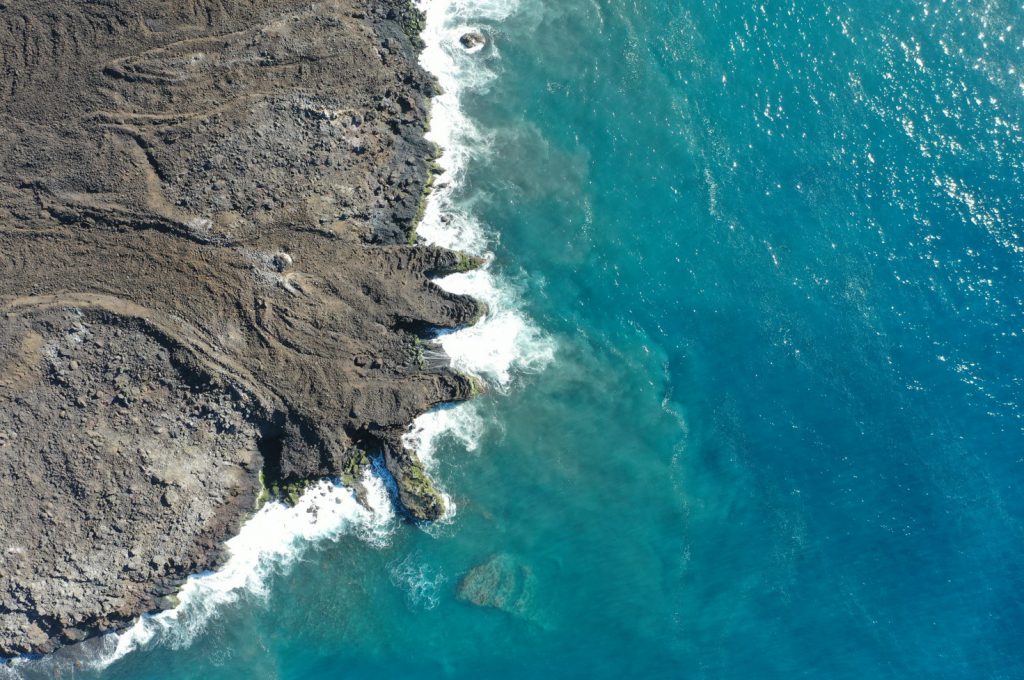
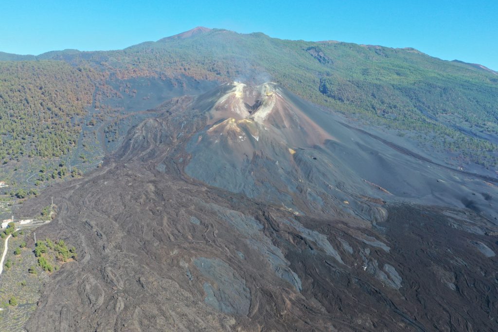
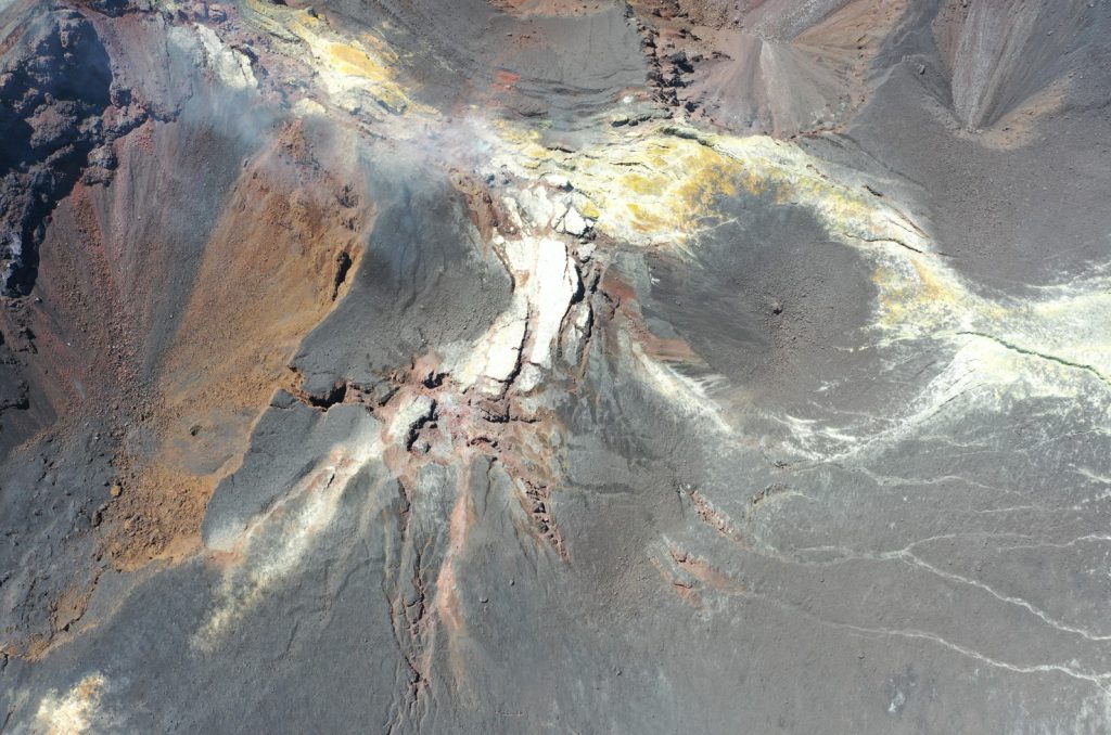
In this context, GeoTenerife has hired our company, Drones for geology To carry out various works, on the island of La Palma, despite the common goal of helping to create a more comprehensive science, and at the same time, with a media career. In addition to the interest of other scientists, it was intended to be useful to all those interested in the volcanic phenomenon. One goal was to create and publish a 3D model of the entire volcano that would be open to the public. Therefore, to achieve this, we are using our drones to image the more than 1,200 hectares that the Tajogaite volcano currently occupies. Next, we process the listed materials and achieve the main goal. Currently, it is already available for everyone who wants to see it on the V3Geo platform. We have included the link at the end of the article to encourage you to view it and receive your impressions and comments.
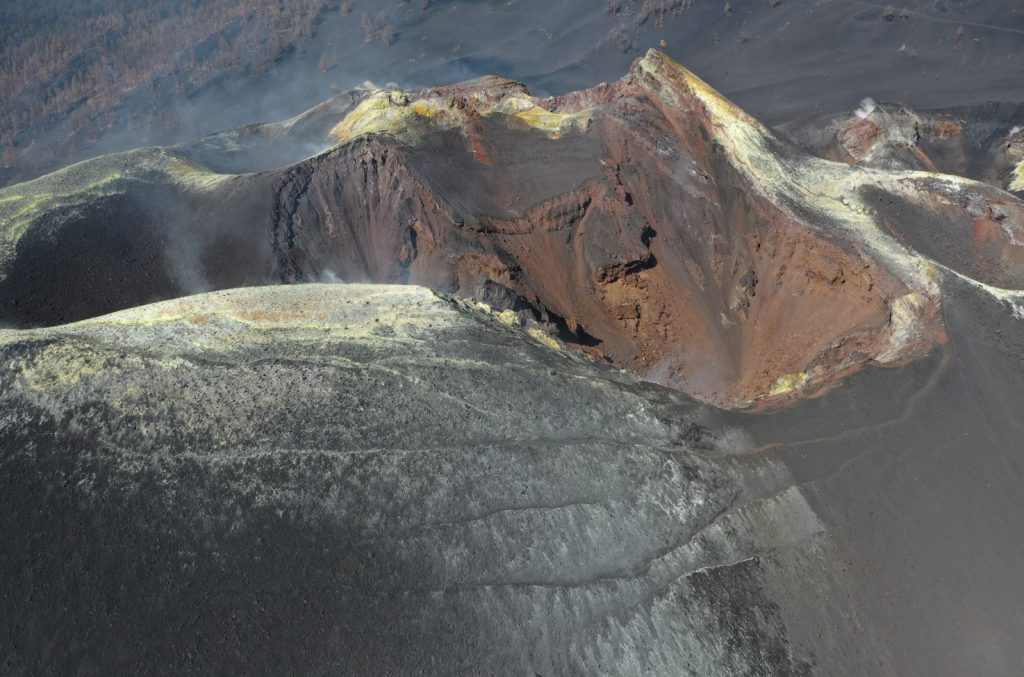
This collaboration allowed us to work in teaching with international master’s and doctoral students on the use of drones applied in Earth sciences. As GeoTenerife conducts trainings for various Earth science professionals and for journalists interested in science communication, this has allowed us to see how important it is to communicate the sensitive information that we scientists deal with in a responsible and transparent manner so that people feel closer to scientists and understand complex situations intuitively. Another major objective is the ability to monitor different sensitive areas in terms of geological risk management, and in this line students of the volcanology course analyzed aerial photographs, digital terrain models and 3D models to observe changes in different areas after two months between the first and second expedition. In addition, it was very nice to be able to notice how this material is also useful for environmental and hydrological purposes, among others, thanks to the cooperation with other professionals.
part of the work Drones for geology He contributed to another aspect of GeoTenerife’s work, the creation of the documentary “Lava Bombs” (available on Apple TV and Google Play) about this explosion, scientific communication and, above all, a focus on the experiences and sensibilities of Palmeros who, above all, wanted to be He is well informed of the critical situation they unfortunately had to live through.
In the future, our goal is to continue to expand knowledge about this phenomenon in a transparent manner, so we hope to continue to help improve both the understanding of natural phenomena and help prevent the resulting consequences. To do this, we opened a new line of action in the areas of the submarine volcano, but we will talk about this in another article …

“Award-winning zombie scholar. Music practitioner. Food expert. Troublemaker.”

/cloudfront-eu-central-1.images.arcpublishing.com/prisa/AHVYMMDSTZDTDBFNZ3LMFUOKNE.jpg "La Palma Eruption “Historicers,” SINC Track and Rafael Bachiller, CSIC-BBVA Science Communication Awards | Sciences")


